
Are you looking for ways to make geography learning more engaging and fun for your students? Map craft projects are an excellent way to do just that! By combining creativity with geographic knowledge, these projects can help students develop their spatial awareness, critical thinking skills, and even storytelling abilities. From creating topographic maps to designing political puzzles, the possibilities are endless. In this article, we’ll explore some exciting map craft project ideas that will take your students on a journey of discovery. We’ll cover how to create thematic mapping for storytelling, make 3D globe models, and more! Whether you’re an educator or a parent looking for ways to inspire young minds, this guide is packed with practical tips and creative inspiration to get you started.
Introduction to Map Crafts
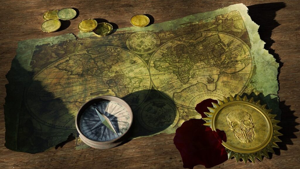
Welcome to the world of map crafts, where geography learning meets creativity! In this section, we’ll explore the basics of making interactive maps that spark curiosity and engagement.
Benefits of Using Maps in Education
Using maps in education has been proven to have a profound impact on geography learning and cognitive skills. By incorporating map-based activities into your teaching repertoire, you can enhance student engagement, improve spatial awareness, and develop critical thinking abilities.
Maps provide an interactive way for students to visualize geographical concepts, allowing them to better comprehend complex relationships between countries, cultures, and environments. For instance, using a world map to track natural disasters or climate patterns can help students understand the effects of globalization on local communities.
Moreover, maps foster spatial reasoning and problem-solving skills by encouraging students to analyze and interpret data. By using real-world examples such as navigating public transportation systems or planning road trips, you can demonstrate how maps are essential tools for everyday life.
To incorporate map-based activities into your classroom, start with simple exercises like labeling continents, oceans, or mountain ranges. Gradually increase the complexity by asking students to create their own maps, incorporating geographical features and cultural symbols. This hands-on approach not only improves geography knowledge but also develops spatial reasoning, critical thinking, and creativity – essential skills for a rapidly changing world.
Brief History of Map Making
The art of map making has been a cornerstone of human exploration and discovery for thousands of years. As we delve into the world of map crafts, it’s essential to understand the evolution of cartography from ancient civilizations to modern mapping techniques.
From the earliest recorded maps on clay tablets in ancient Mesopotamia around 2000 BCE to the intricate hand-drawn maps of medieval Europe, cartographers have continually pushed the boundaries of accuracy and representation. The development of new tools, materials, and technologies has revolutionized map making, allowing for more detailed and precise depictions of our world.
One significant milestone in the history of map making was the advent of printing technology during the Renaissance period. This enabled mass production of maps, making them more accessible to the general public and contributing to a surge in geographical knowledge and exploration. Today, we have access to sophisticated computer-aided design software and satellite imaging, allowing us to create highly detailed and accurate maps with unprecedented precision.
As you embark on your own map crafts journey, remember that understanding this rich history can inspire creativity and inform your approach to representing the world around you.
Types of Map Craft Projects
From puzzle maps and pop-up books, to 3D terrain models and hand-drawn travel journals, there’s a world of creative possibilities for geography learners. Explore these inspiring project ideas below!
Topographic Map Art
Creating topographic map art is an excellent way to visualize and understand real-world landscapes. These projects require careful attention to scale and spatial relationships between different features on the landscape. To start, begin by selecting a location that interests you, such as a mountain range or a coastline. Use a digital tool or software to create a 3D model of the area, taking note of the various landforms, bodies of water, and vegetation.
When creating your topographic map art, it’s essential to consider scale. A small-scale representation might show only the major features, while a larger scale will reveal more detail. Think about how you can convey this sense of depth and dimensionality in your artwork. For example, you could use different colors or textures to indicate elevation changes or vegetation density.
To add an extra layer of realism, focus on accurately representing spatial relationships between features. Use visual cues such as contour lines, rivers, and roads to create a sense of context and connection between elements. With practice and patience, your topographic map art will help you develop a deeper understanding of the relationships between landforms, water bodies, and human activities in different regions.
Political Map Puzzles
Creating political map puzzles is an engaging way to explore national borders and geographic relationships. These puzzles allow children (and adults alike) to learn about countries, their boundaries, and the diversity of cultures across the globe.
To design a puzzle that suits your needs, you’ll first need to select a suitable map image. Choose one that displays clear country outlines, ideally with a large scale for better detail. Some popular options include world maps, continent-specific maps (e.g., Europe or Africa), or regional maps (e.g., the Middle East or Southeast Asia).
When creating your puzzle, consider how challenging you want it to be. Use the 500-piece rule of thumb as a starting point: fewer pieces result in a simpler puzzle for younger learners, while larger puzzles can cater to more advanced geography enthusiasts.
Tips for solving these puzzles include labeling countries and continents once you’ve completed the image; exploring online resources to verify country borders and statistics related to each region.
Thematic Mapping for Storytelling
Thematic mapping is an effective way to visualize data and tell stories about various topics that are relevant to geography learning. By analyzing spatial relationships and patterns on a map, you can create interactive and engaging visualizations that bring complex information to life.
When using thematic maps for storytelling, consider the type of story you want to convey. For instance, if you’re exploring climate change, you might focus on temperature anomalies or sea-level rise. On the other hand, demographic trends might involve population density, urbanization, or migration patterns.
To create a compelling thematic map, start by selecting relevant data sources and geospatial tools. You can use software like QGIS, ArcGIS, or even online platforms like Google My Maps to visualize your data on a map. Experiment with different colors, symbols, and labels to effectively communicate your message.
For example, imagine creating an interactive map that highlights areas of high population growth due to urbanization. By combining demographic data with satellite imagery, you can reveal the spatial patterns and dynamics driving this trend. This approach not only fosters deeper understanding but also sparks curiosity in geography learners to explore more.
Materials and Tools for Map Crafts
To bring your map craft projects to life, you’ll need some essential materials and tools that will help you create accurate and visually appealing maps. Let’s take a look at what you’ll need to get started.
Essential Drawing Tools
When it comes to map crafts, having the right tools can make all the difference. Let’s start with the basics: pencils and erasers. For precision drawing, I recommend using a range of graphite pencils (HB, 2B, 4B, 6B) that allow you to achieve varying levels of darkness and detail. A good quality eraser is essential for correcting mistakes and creating highlights on your map.
A ruler or straightedge is also crucial for ensuring straight lines and accurate measurements. Choose a flexible ruler made from plastic or metal that can be bent to fit into tight spaces. For more intricate designs, consider using a French curve or other specialized tools.
When selecting materials, don’t forget about the importance of creativity and experimentation. Consider trying out different pencil techniques, such as hatching and cross-hatching, to add texture and depth to your map. Additionally, think outside the box with unconventional materials like colored pencils, markers, or even natural materials like leaves or twigs.
Digital Map Making Software
When it comes to map making, digital tools have revolutionized the process, making it more efficient and accessible. One essential tool for geography learning is digital map making software. These programs allow you to create, edit, and print maps with ease.
Some popular options include Adobe Illustrator, Google My Maps, and MapBox Studio. These tools offer a range of features such as customizable templates, layers, and shapes that make it easy to add geographical details like mountains, rivers, and cities. You can also import data from various sources, such as CSV files or spreadsheets, to enhance your map’s accuracy.
One great advantage of digital map making software is the ability to collaborate with others in real-time. This makes it an ideal tool for group projects or classroom activities. For example, you can create a shared document and have multiple students contribute to the map design, ensuring everyone’s ideas are incorporated. Additionally, many of these tools offer automatic scaling and labeling options, saving time and reducing errors.
Tips and Variations for Map Craft Projects
Take your map craft skills to the next level by exploring our tips and variations, from creating mini maps to experimenting with different materials. You’ll love these creative ideas!
Encouraging Creativity in Students
Encouraging creativity in students is an essential aspect of any map craft project. By providing prompts, challenges, and open-ended questions, you can stimulate their imagination and critical thinking skills. Start by presenting students with a hypothetical scenario or a real-world issue that requires mapping solutions.
For example, ask them to design a sustainable transportation system for a fictional city or create a disaster relief plan for an area affected by a natural disaster. This not only encourages creativity but also applies geographical concepts to practical problems.
Another approach is to provide open-ended questions that prompt students to think creatively about map design. You might ask them to visualize the world from different perspectives, such as designing a map for people with visual impairments or creating an interactive 3D model of a cityscape.
Remember to give students freedom to experiment and make mistakes – it’s all part of the creative process! Encourage collaboration among peers by dividing projects into smaller tasks that require input from each member. By allowing students to think outside the box, you’ll foster innovation and problem-solving skills while having fun with geography learning.
Integrating Technology with Traditional Methods
When it comes to map craft projects, one of the most effective ways to make learning geography more engaging is by combining digital mapping tools with hands-on crafts. This integration can lead to a more immersive and interactive experience for students.
One way to do this is by using online mapping platforms like Google My Maps or Mapbox Studio to create custom maps that can be easily accessed on desktop or mobile devices. Students can work together to research and add various geographical features, such as countries, cities, or landmarks, before printing out the map for further exploration through traditional crafts.
For example, students can use colored pencils, markers, or paint to highlight different regions or features on their printed map, making it easier to visualize and understand complex geographical concepts. They can also incorporate 3D elements like cardboard cutouts or clay models of mountains, rivers, or volcanoes to create a more dynamic representation of the landscape.
By combining digital mapping tools with traditional crafts, you can cater to different learning styles and abilities, making map craft projects more inclusive and enjoyable for everyone involved.
Examples of Successful Map Crafts in the Classroom
You’ve tried creating your own map crafts, but want more inspiration. This section shares some amazing examples of successful projects that have brought geography to life for students of all ages.
Student Showcase
When it comes to map craft projects, there’s no better way to showcase student understanding than through their exceptional work. Let’s take a look at some outstanding examples that demonstrate a deep grasp of geography concepts.
For instance, we have Emma’s beautifully crafted 3D model of the Grand Canyon. By layering different materials and textures, she was able to accurately depict the landscape’s unique geological features. Her teacher praised her attention to detail and ability to explain how the Colorado River has shaped the canyon over time.
Another impressive project is Max’s hand-drawn map of the Amazon Rainforest. He carefully labeled each region, including the major rivers and tributaries, demonstrating a clear understanding of the rainforest’s complex ecosystem. His teacher noted that Max had also highlighted the importance of preserving this delicate environment.
These projects not only showcase students’ geographical knowledge but also their creativity and problem-solving skills. When evaluating student map crafts, look for:
* Accurate representation of geographical features
* Ability to explain the relevance of specific concepts
* Demonstration of critical thinking in design choices
Teacher-Tested Lesson Plans
As educators strive to make geography learning engaging and interactive, incorporating map crafts into their lesson plans can be a game-changer. To help you get started, we’ve curated some teacher-tested lesson plans that will guide you through the process of implementing map-based activities into your existing curriculum.
One great example is creating a scale model of a city or region using paper mache or clay. Not only does this activity develop spatial awareness and critical thinking skills, but it also allows students to visualize complex geographical concepts in a tangible way. To create such a project, you’ll need a large map printout, various art supplies, and a measuring tape.
When planning your lesson, consider the following steps:
- Begin by showing students how to measure distances and calculate scales on their maps.
- Have them draw the outline of the city or region on cardboard or paper, using the measured dimensions as a guide.
- Allow students to add 3D details such as buildings, roads, and parks, while reinforcing geographical concepts like elevation and land use.
This activity can be adapted for various grade levels and subject areas, making it an excellent addition to your geography curriculum.
Conclusion and Future Directions
Now that we’ve explored the world of map craft projects, let’s take a step back and reflect on what we’ve learned together so far. This concludes our journey through geography learning made fun!
Recap of Key Takeaways
As we conclude our journey into map craft projects for geography learning, let’s recap the key takeaways to help you integrate this engaging approach into your teaching and parenting practices.
Throughout this article, we’ve explored how hands-on map crafts can foster a deeper understanding of geographical concepts, develop critical thinking skills, and promote visual literacy. We’ve also discussed various techniques to incorporate into your projects, such as using real-world maps, creating 3D models, and incorporating storytelling elements.
To apply these takeaways effectively, consider the following:
* Encourage students to explore different types of maps, including topographic, climate, and cultural maps.
* Use everyday objects to create tactile representations of geographical features, like mountains or rivers.
* Incorporate real-world examples and case studies to illustrate map-related concepts.
* Provide opportunities for students to present their creations and share their knowledge with peers.
By revisiting these key takeaways and incorporating them into your teaching practices, you’ll be well on your way to creating a rich and interactive geography curriculum that sparks curiosity and engagement in your students.
Final Thoughts on Map Craft Projects
As we conclude our exploration of map craft projects for geography learning, it’s essential to reflect on the profound impact these hands-on activities have on students’ spatial awareness, critical thinking, and problem-solving skills. By engaging with maps and geographic concepts through creative, tactile experiences, learners develop a deeper understanding of the world around them.
The benefits of map craft projects extend beyond mere academic achievement; they foster a lasting appreciation for geography and its relevance to everyday life. As educators, we can leverage this enthusiasm to encourage students to explore real-world applications of geographic knowledge, such as sustainable development, urban planning, or environmental conservation.
To maximize the effectiveness of map craft projects in your classroom, remember to provide opportunities for students to design their own maps, incorporating personal experiences and perspectives. This approach not only promotes creativity but also helps learners connect abstract concepts to tangible realities. By embracing this hands-on approach, we empower students to become more informed, engaged global citizens.
Frequently Asked Questions
Can I adapt map craft projects for students with different learning abilities?
Concise, valuable answer…
You can easily adapt map craft projects to suit students with different learning needs. For example, you can provide pre-cut shapes and materials for students who struggle with fine motor skills or offer alternative formats like digital maps for students who need accommodations.
How do I incorporate technology into traditional map crafts?
Another helpful answer…
Incorporating technology into traditional map crafts is easier than you think! You can use digital mapping software to create interactive layers, 3D models, and even augmented reality experiences. Some popular tools include Google My Maps, Mapbox Studio, or Adobe Illustrator.
What are some tips for displaying student map craft projects in the classroom?
Concise, valuable answer…
Displaying student work is an essential part of any educational project. For map crafts, consider creating a gallery wall with display boards or using a digital platform like Padlet to showcase student creations. You can also have students present their projects and share the process behind making them.
How do I encourage students to take ownership of their map craft projects?
Concise, valuable answer…
Encouraging student autonomy is key! For map crafts, provide open-ended prompts that allow students to explore different themes and ideas. Offer choices in materials, tools, or even the type of project itself (e.g., 2D vs. 3D). This will help build their confidence and motivation.
Can I use recycled materials for my map craft projects?
Concise, valuable answer…
Get creative with what you have! Using recycled materials is a great way to make your map crafts more eco-friendly and budget-friendly. Think cardboard tubes as mountain ranges or old maps as inspiration for themed backgrounds. This approach also fosters critical thinking about waste management.
How do I assess student learning through map craft projects?
Concise, valuable answer…
Assessing student learning can be done in various ways. For map crafts, consider the process over the product: observe students’ ability to think spatially and critically while working on a project. You can also use rubrics or peer review assessments to evaluate their work.